
Sunday, 15 November 2026
The Dhaka News

Bangladesh Plans Satellite-Based Surveillance System to Protect Deep-Sea Fishermen

Bangladesh Plans Satellite-Based Surveillance System to Protect Deep-Sea Fishermen
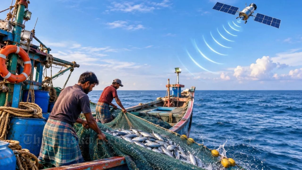
Photo: Collected

The government is planning to introduce a satellite-based surveillance system to help protect fishermen who face emergencies while fishing in deep waters due to storms, accidents or mechanical failures. The initiative aims to enable authorities to identify the locations of fishing vessels and respond more quickly during emergencies in the Bay of Bengal.

Under the proposed system, the movement and positions of fishing vessels across the Bay of Bengal will be monitored through satellite technology. This would make it possible to track vessels operating far beyond coastal areas, while also strengthening maritime security, improving fisheries management and unlocking new opportunities in the country's blue economy.

Bangladesh Satellite Company Limited (BSCL) is planning to establish a satellite-based Automatic Identification System (AIS) to achieve these objectives. The estimated cost of the project is approximately Tk 6 billion.

According to BSCL officials, Bangladesh has a maritime area of approximately 118,813 square kilometres, which contains significant fisheries resources, marine biodiversity and economic potential. However, maintaining regular surveillance across such an extensive maritime zone remains a major challenge.

To address this, the proposed project includes four Low Earth Orbit (LEO) satellites, two ground stations and local server infrastructure for storing and processing data. This would allow important information about maritime vessels to be stored and managed through Bangladesh's own infrastructure, reducing dependence on foreign third-party service providers.

Bangladesh's first satellite, Bangabandhu Satellite-1, currently in orbit, was primarily designed to provide telecommunications and broadcasting services. The proposed AIS satellite system, however, would be a specialised initiative focused on monitoring maritime vessels.

The project aims to ensure a maximum revisit time of 30 minutes across the entire Bay of Bengal. This means that after a particular area has been observed by a satellite, it would be possible to monitor the same area again within a maximum of 30 minutes.

Through this system, authorities would be able to analyse the number of vessels operating in different areas, identify locations with intensive fishing activities and detect vessels moving outside designated zones. The technology could also support efforts to control overfishing, conserve marine species and develop sustainable fisheries management strategies.

A feasibility study for the project is currently underway. Implementation will begin after finalising the technical design, financing arrangements, satellite manufacturer selection and necessary infrastructure. According to the plan, the satellite-based surveillance service is targeted for launch by 2028.

Improved Safety and Rescue Operations for Fishermen

Fishing vessels in the Bay of Bengal frequently encounter storms, rough waves, mechanical failures and other accidents. When vessels travel far from the coast, they often move beyond the coverage of mobile networks, making it difficult for authorities to determine their exact locations in emergencies.

In many cases, locating missing fishing vessels requires lengthy search operations.

Once the proposed satellite-based AIS system becomes operational, authorities will be able to monitor the movements of AIS-equipped vessels even in remote areas far from the coastline.

This will help identify the locations of vessels involved in accidents or caught in severe weather conditions. It will also make rescue operations easier for the Bangladesh Navy, Coast Guard and other relevant agencies.

In addition, analysing vessel movement data could help establish more efficient routes, reduce unnecessary travel and save fuel.

According to BSCL's preliminary estimates, a fishing vessel could save up to 150 litres of diesel on a single trip through better route planning. Based on these calculations, the system has the potential to save approximately 45 million litres of fuel annually.

Satellite Data to Support Sustainable Fisheries Management

The introduction of the satellite-based AIS system would create opportunities to collect and preserve long-term data on vessel movements and fishing activities across the Bay of Bengal.

Information about the areas vessels visit, when they engage in fishing and when they return to shore could be analysed to develop a comprehensive database of marine fishing activities.

Such information could play an important role in the sustainable management of fisheries resources. By monitoring patterns of excessive fishing, vessel presence during specific periods and changes in fishing activities across different areas, authorities would be able to develop more effective management strategies.

However, AIS technology is not designed to directly detect the location of fish in the sea. Its primary purpose is to identify vessels and monitor their positions and movements.

Determining where fish are most likely to be found requires analysing several oceanographic factors, including water temperature, ocean colour, chlorophyll concentration, plankton distribution and ocean currents. Satellite remote sensing, along with technologies such as sonar and echo sounders, can be used for this purpose.

In other words, AIS identifies where a vessel is operating, while marine science-based technologies help determine which areas are more likely to contain fish.

The combined use of these technologies could create new opportunities for modern, data-driven fisheries management in the Bay of Bengal.

BSCL Highlights Importance of Maritime Surveillance

Speaking about the initiative, Dr. Muhammad Imadur Rahman, Managing Director of Bangladesh Satellite Company Limited, said the Bay of Bengal is an important economic asset for Bangladesh. He stressed that establishing a technology-driven surveillance system is essential to protecting its resources, ensuring proper management and strengthening maritime security.

He said the proposed satellite-based AIS system would enable authorities to regularly monitor the positions and movements of fishing vessels operating in deep waters. As a result, if a vessel encounters an accident or natural disaster, its location could be identified more quickly, helping facilitate rescue operations.

Muhammad Imadur Rahman further said, "We want to establish a system through which important information about Bangladesh's marine resources and vessels can be stored and managed using the country's own satellite and server infrastructure."

He described the initiative as more than just a technological project, calling it an important step towards developing Bangladesh's maritime economy, ensuring fishermen's safety and protecting maritime sovereignty.

He added that analysing vessel movement and fishing activity data could also play an effective role in sustainable marine resource management, preventing illegal and unregulated fishing, and reducing fuel consumption.

Stay connected with The Dhaka News

The Dhaka News

রোববার, ১৫ নভেম্বর ২০২৬


Bangladesh Plans Satellite-Based Surveillance System to Protect Deep-Sea Fishermen

Published : ১৪ নভেম্বর ২০২৬

featured Image
The government is planning to introduce a satellite-based surveillance system to help protect fishermen who face emergencies while fishing in deep waters due to storms, accidents or mechanical failures. The initiative aims to enable authorities to identify the locations of fishing vessels and respond more quickly during emergencies in the Bay of Bengal.Under the proposed system, the movement and positions of fishing vessels across the Bay of Bengal will be monitored through satellite technology. This would make it possible to track vessels operating far beyond coastal areas, while also strengthening maritime security, improving fisheries management and unlocking new opportunities in the country's blue economy.Bangladesh Satellite Company Limited (BSCL) is planning to establish a satellite-based Automatic Identification System (AIS) to achieve these objectives. The estimated cost of the project is approximately Tk 6 billion.According to BSCL officials, Bangladesh has a maritime area of approximately 118,813 square kilometres, which contains significant fisheries resources, marine biodiversity and economic potential. However, maintaining regular surveillance across such an extensive maritime zone remains a major challenge.To address this, the proposed project includes four Low Earth Orbit (LEO) satellites, two ground stations and local server infrastructure for storing and processing data. This would allow important information about maritime vessels to be stored and managed through Bangladesh's own infrastructure, reducing dependence on foreign third-party service providers.Bangladesh's first satellite, Bangabandhu Satellite-1, currently in orbit, was primarily designed to provide telecommunications and broadcasting services. The proposed AIS satellite system, however, would be a specialised initiative focused on monitoring maritime vessels.The project aims to ensure a maximum revisit time of 30 minutes across the entire Bay of Bengal. This means that after a particular area has been observed by a satellite, it would be possible to monitor the same area again within a maximum of 30 minutes.Through this system, authorities would be able to analyse the number of vessels operating in different areas, identify locations with intensive fishing activities and detect vessels moving outside designated zones. The technology could also support efforts to control overfishing, conserve marine species and develop sustainable fisheries management strategies.A feasibility study for the project is currently underway. Implementation will begin after finalising the technical design, financing arrangements, satellite manufacturer selection and necessary infrastructure. According to the plan, the satellite-based surveillance service is targeted for launch by 2028. Improved Safety and Rescue Operations for FishermenFishing vessels in the Bay of Bengal frequently encounter storms, rough waves, mechanical failures and other accidents. When vessels travel far from the coast, they often move beyond the coverage of mobile networks, making it difficult for authorities to determine their exact locations in emergencies.In many cases, locating missing fishing vessels requires lengthy search operations.Once the proposed satellite-based AIS system becomes operational, authorities will be able to monitor the movements of AIS-equipped vessels even in remote areas far from the coastline.This will help identify the locations of vessels involved in accidents or caught in severe weather conditions. It will also make rescue operations easier for the Bangladesh Navy, Coast Guard and other relevant agencies.In addition, analysing vessel movement data could help establish more efficient routes, reduce unnecessary travel and save fuel.According to BSCL's preliminary estimates, a fishing vessel could save up to 150 litres of diesel on a single trip through better route planning. Based on these calculations, the system has the potential to save approximately 45 million litres of fuel annually. Satellite Data to Support Sustainable Fisheries ManagementThe introduction of the satellite-based AIS system would create opportunities to collect and preserve long-term data on vessel movements and fishing activities across the Bay of Bengal.Information about the areas vessels visit, when they engage in fishing and when they return to shore could be analysed to develop a comprehensive database of marine fishing activities.Such information could play an important role in the sustainable management of fisheries resources. By monitoring patterns of excessive fishing, vessel presence during specific periods and changes in fishing activities across different areas, authorities would be able to develop more effective management strategies.However, AIS technology is not designed to directly detect the location of fish in the sea. Its primary purpose is to identify vessels and monitor their positions and movements.Determining where fish are most likely to be found requires analysing several oceanographic factors, including water temperature, ocean colour, chlorophyll concentration, plankton distribution and ocean currents. Satellite remote sensing, along with technologies such as sonar and echo sounders, can be used for this purpose.In other words, AIS identifies where a vessel is operating, while marine science-based technologies help determine which areas are more likely to contain fish.The combined use of these technologies could create new opportunities for modern, data-driven fisheries management in the Bay of Bengal. BSCL Highlights Importance of Maritime SurveillanceSpeaking about the initiative, Dr. Muhammad Imadur Rahman, Managing Director of Bangladesh Satellite Company Limited, said the Bay of Bengal is an important economic asset for Bangladesh. He stressed that establishing a technology-driven surveillance system is essential to protecting its resources, ensuring proper management and strengthening maritime security.He said the proposed satellite-based AIS system would enable authorities to regularly monitor the positions and movements of fishing vessels operating in deep waters. As a result, if a vessel encounters an accident or natural disaster, its location could be identified more quickly, helping facilitate rescue operations.Muhammad Imadur Rahman further said, "We want to establish a system through which important information about Bangladesh's marine resources and vessels can be stored and managed using the country's own satellite and server infrastructure."He described the initiative as more than just a technological project, calling it an important step towards developing Bangladesh's maritime economy, ensuring fishermen's safety and protecting maritime sovereignty.He added that analysing vessel movement and fishing activity data could also play an effective role in sustainable marine resource management, preventing illegal and unregulated fishing, and reducing fuel consumption.

The Dhaka News

Editor: Taskin Ahmed Riyad 

Copyright © ২০২৬ The Dhaka News । All Right Reserved